Geolocate

Kebonalas topographic map

Click on the map to display elevation.

About this map

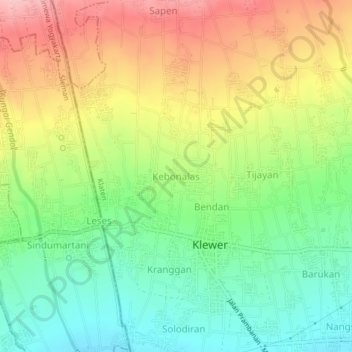
Name: Kebonalas topographic map, elevation, terrain.

Location: Kebonalas, Klaten, Central Java, Java, 57485, Indonesia (-7.70817 110.46954 -7.66817 110.50954)

Average elevation: 298 m

Minimum elevation: 225 m

Maximum elevation: 391 m

Other topographic maps

Click on a map to view its topography, its elevation and its terrain.

Sanggrahan

Indonesia > Central Java > Klaten

Average elevation: 150 m

Sungai

Indonesia > Central Java > Klaten > Nanggulan

Average elevation: 113 m

Gear up for your next adventure:

🏕️Camping Hammock - Integrated protection for sleeping between trees
🦌Outdoor Trail Camera - Monitor wildlife activity near your favorite spots
💧Filtered Water Bottle - Safe drinking water on the go
🧊Portable Cooler - Keep food and drinks cold during outdoor adventures
🔭Compact Monocular - One-handed bird watching and trail spotting

As an Amazon Associate, this site earns from qualifying purchases at no extra cost to you.