
Thank you for supporting this site ❤️
Make a donation
Make a donation
Gear up for your next adventure:
As an Amazon Associate, this site earns from qualifying purchases at no extra cost to you.
Sekenani topographic map
Click on the map to display elevation.
Thank you for supporting this site ❤️
Make a donation
Make a donation
Gear up for your next adventure:
As an Amazon Associate, this site earns from qualifying purchases at no extra cost to you.
About this map
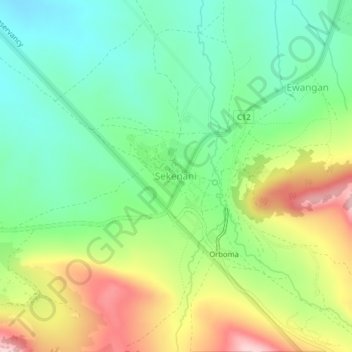
Name: Sekenani topographic map, elevation, terrain.
Location: Sekenani, Siana ward, Narok West, Narok, Rift Valley, Kenya (-1.53802 35.31788 -1.49802 35.35788)
Average elevation: 1,732 m
Minimum elevation: 1,645 m
Maximum elevation: 1,876 m
Thank you for supporting this site ❤️
Make a donation
Make a donation
Gear up for your next adventure:
As an Amazon Associate, this site earns from qualifying purchases at no extra cost to you.