Geolocate

Desmotadora topographic map

Click on the map to display elevation.

About this map

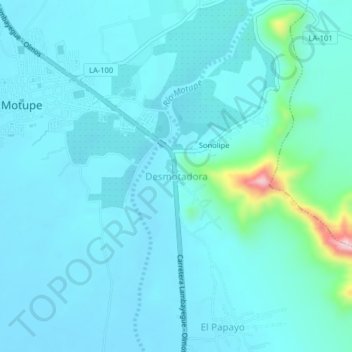
Name: Desmotadora topographic map, elevation, terrain.

Location: Desmotadora, Motupe, Lambayeque, Perú (-6.18254 -79.71937 -6.14254 -79.67937)

Average elevation: 152 m

Minimum elevation: 120 m

Maximum elevation: 408 m

Gear up for your next adventure:

🧼Biodegradable Camp Soap - Environmentally friendly cleaning for gear and body
🦶Anti-Blister Balm - Prevents friction and hotspots during long ascents
🛌Down Sleeping Bag - Superior warmth-to-weight ratio for cold nights
🛶Kayak Accessories - Essential gear for safe and fun kayaking adventures
🥾Mountain Trail Shoes - High-traction shoes for mountain trails

As an Amazon Associate, this site earns from qualifying purchases at no extra cost to you.