Geolocate

Guabiraba topographic map

Click on the map to display elevation.

About this map

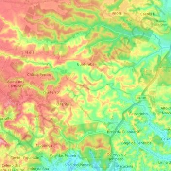
Name: Guabiraba topographic map, elevation, terrain.

Location: Guabiraba, Recife, Região Geográfica Imediata do Recife, Região Metropolitana do Recife, Pernambuco, Northeast Region, Brazil (-8.00242 -35.00840 -7.92897 -34.90943)

Average elevation: 69 m

Minimum elevation: 4 m

Maximum elevation: 134 m

Other topographic maps

Click on a map to view its topography, its elevation and its terrain.

Gear up for your next adventure:

🧴Bear Spray Holster - Quick-access carry for essential Canadian wilderness safety
🔭Compact Monocular - One-handed bird watching and trail spotting
🛶Kayak Dry Bag - Waterproof storage for kayaking adventures
🕶️Polarized Sunglasses - Reduces glare from snow and water at high elevations
🚲Handlebar Phone Mount - View topographic-map.com live while cycling

As an Amazon Associate, this site earns from qualifying purchases at no extra cost to you.