
Thank you for supporting this site ❤️
Make a donation
Make a donation
Gear up for your next adventure:
As an Amazon Associate, this site earns from qualifying purchases at no extra cost to you.
Nallampalli topographic map
Click on the map to display elevation.
Thank you for supporting this site ❤️
Make a donation
Make a donation
Gear up for your next adventure:
As an Amazon Associate, this site earns from qualifying purchases at no extra cost to you.
About this map
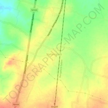
Name: Nallampalli topographic map, elevation, terrain.
Location: Nallampalli, Dharmapuri, Tamil Nadu, 636807, India (12.03743 78.09811 12.07743 78.13811)
Average elevation: 487 m
Minimum elevation: 458 m
Maximum elevation: 508 m
Thank you for supporting this site ❤️
Make a donation
Make a donation
Gear up for your next adventure:
As an Amazon Associate, this site earns from qualifying purchases at no extra cost to you.