
Thank you for supporting this site ❤️
Make a donation
Make a donation
Gear up for your next adventure:
As an Amazon Associate, this site earns from qualifying purchases at no extra cost to you.
永胜村 topographic map
Click on the map to display elevation.
Thank you for supporting this site ❤️
Make a donation
Make a donation
Gear up for your next adventure:
As an Amazon Associate, this site earns from qualifying purchases at no extra cost to you.
About this map
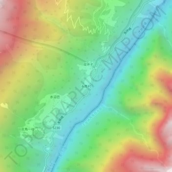
Name: 永胜村 topographic map, elevation, terrain.
Location: 永胜村, Hutiaoxia, Shangri-La, Diqing, Yunnan, China (27.20020 100.10756 27.24020 100.14756)
Average elevation: 2,491 m
Minimum elevation: 1,719 m
Maximum elevation: 3,772 m
Thank you for supporting this site ❤️
Make a donation
Make a donation
Gear up for your next adventure:
As an Amazon Associate, this site earns from qualifying purchases at no extra cost to you.