Geolocate

Buckland topographic map

Click on the map to display elevation.

About this map

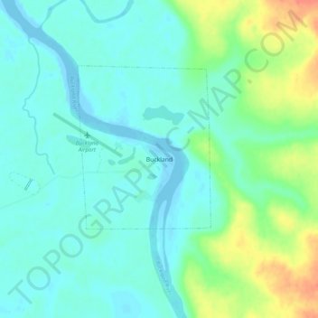
Name: Buckland topographic map, elevation, terrain.

Location: Buckland, Northwest Arctic, Alaska, 99727, United States (65.95852 -161.14688 65.99852 -161.10688)

Average elevation: 13 m

Minimum elevation: -6 m

Maximum elevation: 51 m

Gear up for your next adventure:

🥾Approach Shoes - Shoes designed for climbing approaches and rugged trails
🧢Sun Protection Cap - Breathable cap to protect from sun exposure
🧥Waterproof Jacket - Lightweight rain jackets for hiking and outdoor activities
🚑Survival Whistle - Signal for help across long distances in mountains
🔥Emergency Fire Starter - Reliable ignition source for all weather conditions

As an Amazon Associate, this site earns from qualifying purchases at no extra cost to you.