
Center Groton topographic map
Click on the map to display elevation.
About this map
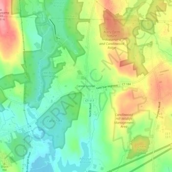
Name: Center Groton topographic map, elevation, terrain.
Average elevation: 49 m
Minimum elevation: 4 m
Maximum elevation: 113 m
Other topographic maps
Click on a map to view its topography, its elevation and its terrain.
Fort Griswold
United States > Connecticut > Southeastern Connecticut Planning Region > Groton
Average elevation: 19 m
Noank
United States > Connecticut > Southeastern Connecticut Planning Region > Groton > Noank
Average elevation: 15 m
Old Mystic
United States > Connecticut > Southeastern Connecticut Planning Region > Groton > Old Mystic
Average elevation: 42 m