Geolocate

Betong topographic map

Click on the map to display elevation.

About this map

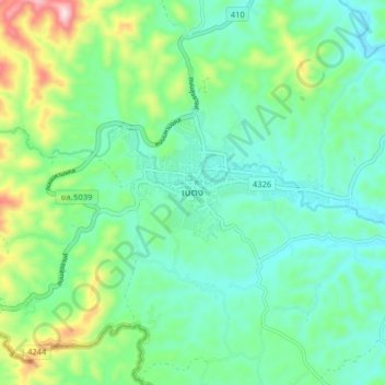
Name: Betong topographic map, elevation, terrain.

Location: Betong, Than Nam Thip, Betong, Yala Province, Thailand (5.73182 101.03152 5.81182 101.11152)

Average elevation: 333 m

Minimum elevation: 228 m

Maximum elevation: 634 m

Gear up for your next adventure:

🧢Hiking Sun Hat - Wide-brimmed protection for exposed mountain ridges
🍽️Titanium Camping Spork - Ultralight and indestructible eating utensil
🌬️Windproof Camp Stove - Efficient cooking even on exposed mountain peaks
🛶Kayak Accessories - Essential gear for safe and fun kayaking adventures
🦟Insect Repellent - Keep mosquitoes and black flies away in wooded areas

As an Amazon Associate, this site earns from qualifying purchases at no extra cost to you.