Geolocate

Kanadi topographic map

Click on the map to display elevation.

About this map

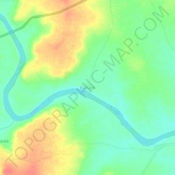
Name: Kanadi topographic map, elevation, terrain.

Location: Kanadi, Mantha, Jalna District, Maharashtra, India (19.83206 76.44508 19.87206 76.48508)

Average elevation: 491 m

Minimum elevation: 467 m

Maximum elevation: 524 m

Gear up for your next adventure:

Camping Tent - Weather-resistant tents suitable for 2 to 6 people
🧴Insect Repellent - Protect yourself from bugs during outdoor adventures
🧊Insulated Water Bottle - Keeps drinks cold in summer and prevents freezing in winter
🥾Lightweight Hiking Shoes - Comfortable shoes for day hikes
🧥Thermal Fleece Jacket - Versatile insulation for changing mountain temperatures

As an Amazon Associate, this site earns from qualifying purchases at no extra cost to you.