
Tone District topographic map
Interactive map
Click on the map to display elevation.
About this map
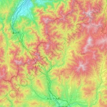
Name: Tone District topographic map, elevation, terrain.
Location: Minakami, Tone District, Gunma Prefecture, Kanto, Japan (36.64460 138.78941 37.05863 139.19815)
Average elevation: 1,021 m
Minimum elevation: 162 m
Maximum elevation: 2,201 m