Geolocate

Gavimatha topographic map

Click on the map to display elevation.

About this map

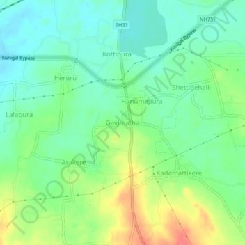
Name: Gavimatha topographic map, elevation, terrain.

Location: Gavimatha, Kunigal taluk, Tumakuru, Karnataka, 572130, India (12.97438 77.00262 13.01438 77.04262)

Average elevation: 775 m

Minimum elevation: 753 m

Maximum elevation: 816 m

Gear up for your next adventure:

🥾Hiking Boots - Sturdy boots providing ankle support and traction on rugged trails
🧥Fleece Jacket - Warm and lightweight jacket for layering
🥾Light Trekking Boots - Supportive boots for multi-day treks
🥾Mountain Trail Shoes - High-traction shoes for mountain trails
🔋Lithium AA Batteries - Long-lasting power that performs in extreme cold

As an Amazon Associate, this site earns from qualifying purchases at no extra cost to you.