
Thank you for supporting this site ❤️
Make a donation
Make a donation
Gear up for your next adventure:
As an Amazon Associate, this site earns from qualifying purchases at no extra cost to you.
Lufrei topographic map
Click on the map to display elevation.
Thank you for supporting this site ❤️
Make a donation
Make a donation
Gear up for your next adventure:
As an Amazon Associate, this site earns from qualifying purchases at no extra cost to you.
About this map
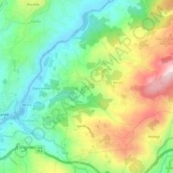
Name: Lufrei topographic map, elevation, terrain.
Location: Lufrei, Amarante, Porto, 4600-079, Portugal (41.25641 -8.07353 41.29641 -8.03353)
Average elevation: 215 m
Minimum elevation: 64 m
Maximum elevation: 459 m
Thank you for supporting this site ❤️
Make a donation
Make a donation
Gear up for your next adventure:
As an Amazon Associate, this site earns from qualifying purchases at no extra cost to you.