
Thank you for supporting this site ❤️
Make a donation
Make a donation
Gear up for your next adventure:
As an Amazon Associate, this site earns from qualifying purchases at no extra cost to you.
Göynükbelen topographic map
Click on the map to display elevation.
Thank you for supporting this site ❤️
Make a donation
Make a donation
Gear up for your next adventure:
As an Amazon Associate, this site earns from qualifying purchases at no extra cost to you.
About this map
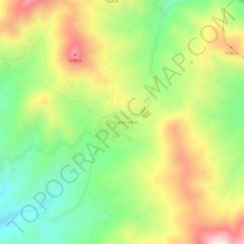
Name: Göynükbelen topographic map, elevation, terrain.
Location: Göynükbelen, Orhaneli, Bursa, Marmara Region, Turkey (39.97005 29.02756 40.01005 29.06756)
Average elevation: 975 m
Minimum elevation: 701 m
Maximum elevation: 1,327 m
Thank you for supporting this site ❤️
Make a donation
Make a donation
Gear up for your next adventure:
As an Amazon Associate, this site earns from qualifying purchases at no extra cost to you.