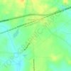
Rixeyville topographic map
Click on the map to display elevation.
About this map

Name: Rixeyville topographic map, elevation, terrain.
Location: Rixeyville, Culpeper County, Virginia, 22737, United States (38.55972 -77.99887 38.59972 -77.95887)
Average elevation: 119 m
Minimum elevation: 87 m
Maximum elevation: 154 m
Other topographic maps
Click on a map to view its topography, its elevation and its terrain.

Culpeper
United States > Virginia > Culpeper County
Culpeper’s terrain is characterized by rolling hills within the Piedmont Plateau, in the foothills of the Blue Ridge Mountains. Elevation ranges from about 300 feet in the east to nearly 600 feet in the west. The county is bounded by the Rappahannock River to the north and the Rapidan River to the south.
Average elevation: 131 m