

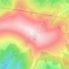
Brezno topographic map
Click on the map to display elevation.
Brezno
The municipality lies at an altitude of 504 metres (1,654 ft) and covers an area of 121.95 km2 (47.09 sq mi) (2024).
About this map

Name: Brezno topographic map, elevation, terrain.
Average elevation: 870 m
Minimum elevation: 448 m
Maximum elevation: 2,028 m
Other topographic maps
Click on a map to view its topography, its elevation and its terrain.

Chopok
Slovakia > Region of Banská Bystrica > District of Brezno > Horná Lehota
Average elevation: 1,642 m
Kráľova hoľa
Slovakia > Region of Banská Bystrica > District of Brezno
Kráľova hoľa (Slovak pronunciation: [ˈkraːʎɔʋa ˈɦɔʎa]; German: Königsberg; Hungarian: Király-hegy, literally "King's Mountain") is the highest mountain (1,946 m) of the eastern part of the Low Tatras in central Slovakia. Four rivers rise at its foot: Čierny Váh, Hnilec, Hornád, and Hron. The…
Average elevation: 1,653 m
Chopok
Slovakia > Region of Banská Bystrica > District of Brezno > Horná Lehota
Average elevation: 1,642 m
Chopok
Slovakia > Region of Banská Bystrica > District of Brezno > Horná Lehota
Average elevation: 1,642 m