
Make a donation
Gear up for your next adventure:
As an Amazon Associate, this site earns from qualifying purchases at no extra cost to you.
Acme topographic map
Click on the map to display elevation.
Make a donation
Gear up for your next adventure:
As an Amazon Associate, this site earns from qualifying purchases at no extra cost to you.
About this map
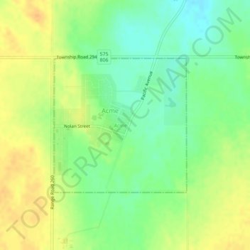
Name: Acme topographic map, elevation, terrain.
Location: Acme, Alberta, T0M 0A0, Kanada (51.48876 -113.52067 51.50325 -113.49771)
Average elevation: 913 m
Minimum elevation: 895 m
Maximum elevation: 926 m
Make a donation
Gear up for your next adventure:
As an Amazon Associate, this site earns from qualifying purchases at no extra cost to you.
Other topographic maps
Click on a map to view its topography, its elevation and its terrain.
Lake Louise
Kanada > Alberta > Improvement District No. 9
Lake Louise ist in drei Ortsteile gegliedert. Der Hauptort, der als The Village of Lake Louise bezeichnet wird, liegt auf einer niedrigen Höhe im Talgrund. Das östlich gelegene Skigebiet Lake Louise Mountain Resort gruppiert sich mit mehreren Gondelbahnen und Sesselliften hauptsächlich am Mount Richardson…
Average elevation: 1,617 m
Make a donation
Gear up for your next adventure:
As an Amazon Associate, this site earns from qualifying purchases at no extra cost to you.
Victoria Ridge
Kanada > Alberta > Municipal District of Pincher Creek No. 9
Average elevation: 2,194 m