Geolocate

Sloviansk topographic map

Click on the map to display elevation.

About this map
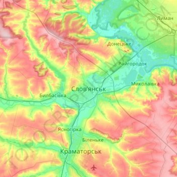
Name: Sloviansk topographic map, elevation, terrain.

Location: Sloviansk, Sloviansk Urban Hromada, Kramatorsk Raion, Donetsk Oblast, 84100-84129, Ukraine (48.69227 37.44582 49.01227 37.76582)

Average elevation: 131 m

Minimum elevation: 52 m

Maximum elevation: 245 m

Other topographic maps

Click on a map to view its topography, its elevation and its terrain.

Weiss Lake

Ukraine > Donetsk Oblast > Sloviansk

Average elevation: 71 m

Gear up for your next adventure:

🥾Hiking Boots - Sturdy boots providing ankle support and traction on rugged trails
🧥Waterproof Hiking Jacket - Protect yourself from rain and wind while hiking
🥫Freeze-Dried Meals - Lightweight, high-calorie nutrition for multi-day treks
🧢Hiking Hat - Sun-protective and breathable hats for long treks
🐕Hiking Dog Pack - Let your canine companion carry their own water and food

As an Amazon Associate, this site earns from qualifying purchases at no extra cost to you.