
Thank you for supporting this site ❤️
Make a donation
Make a donation
Gear up for your next adventure:
As an Amazon Associate, this site earns from qualifying purchases at no extra cost to you.
Bonnyrigg topographic map
Click on the map to display elevation.
Thank you for supporting this site ❤️
Make a donation
Make a donation
Gear up for your next adventure:
As an Amazon Associate, this site earns from qualifying purchases at no extra cost to you.
About this map
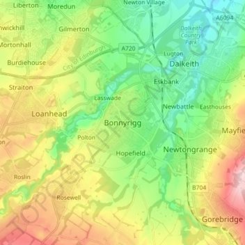
Name: Bonnyrigg topographic map, elevation, terrain.
Location: Bonnyrigg, Midlothian, Scotland, EH19 2DA, United Kingdom (55.83512 -3.14591 55.91512 -3.06591)
Average elevation: 114 m
Minimum elevation: 25 m
Maximum elevation: 257 m
Thank you for supporting this site ❤️
Make a donation
Make a donation
Gear up for your next adventure:
As an Amazon Associate, this site earns from qualifying purchases at no extra cost to you.