Geolocate

Bonnyrigg topographic map

Click on the map to display elevation.

About this map

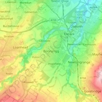
Name: Bonnyrigg topographic map, elevation, terrain.

Location: Bonnyrigg, Midlothian, Scotland, EH19 2DA, United Kingdom (55.83512 -3.14591 55.91512 -3.06591)

Average elevation: 114 m

Minimum elevation: 25 m

Maximum elevation: 257 m

Gear up for your next adventure:

🔦LED Headtorch - Bright and durable light for night activities
🥾Mountain Hiking Boots - High-traction boots for rocky terrain
🥾Trail Hiking Socks - Comfortable socks to prevent blisters and fatigue
💡LED Camping Lantern - Illuminate your campsite with long-lasting lanterns
🥾Hiking Gaiters - Protect legs and shoes from mud, snow, and debris

As an Amazon Associate, this site earns from qualifying purchases at no extra cost to you.