
Thank you for supporting this site ❤️
Make a donation
Make a donation
Gear up for your next adventure:
As an Amazon Associate, this site earns from qualifying purchases at no extra cost to you.
Trashigang topographic map
Click on the map to display elevation.
Thank you for supporting this site ❤️
Make a donation
Make a donation
Gear up for your next adventure:
As an Amazon Associate, this site earns from qualifying purchases at no extra cost to you.
About this map
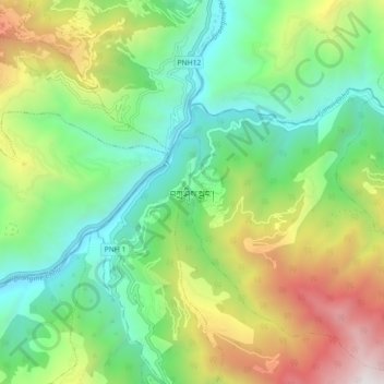
Name: Trashigang topographic map, elevation, terrain.
Location: Trashigang, Samkhar Gewog, Trashigang District, 42001, Bhutan (27.29128 91.51207 27.37128 91.59207)
Average elevation: 1,441 m
Minimum elevation: 633 m
Maximum elevation: 2,982 m
Thank you for supporting this site ❤️
Make a donation
Make a donation
Gear up for your next adventure:
As an Amazon Associate, this site earns from qualifying purchases at no extra cost to you.