Geolocate

Redwood topographic map

Click on the map to display elevation.

About this map

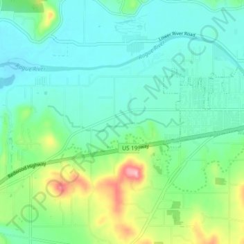
Name: Redwood topographic map, elevation, terrain.

Location: Redwood, Josephine County, Oregon, United States (42.40071 -123.42082 42.43844 -123.34845)

Average elevation: 300 m

Minimum elevation: 260 m

Maximum elevation: 422 m

Other topographic maps

Click on a map to view its topography, its elevation and its terrain.

Three Pines

United States > Oregon > Josephine County

Average elevation: 372 m

Hugo

United States > Oregon > Josephine County

Average elevation: 478 m

Murphy

United States > Oregon > Josephine County

Average elevation: 393 m

Lake Selmac

United States > Oregon > Josephine County

Average elevation: 444 m

Wonder

United States > Oregon > Josephine County

Average elevation: 447 m

Williams

United States > Oregon > Josephine County

Average elevation: 484 m

Wolf Creek

United States > Oregon > Josephine County

Average elevation: 522 m

Merlin

United States > Oregon > Josephine County

Average elevation: 308 m

Provolt

United States > Oregon > Josephine County > Provolt

Average elevation: 394 m

Galice

United States > Oregon > Josephine County

Average elevation: 402 m

Gear up for your next adventure:

🌬️Windproof Camp Stove - Efficient cooking even on exposed mountain peaks
🧥Thermal Fleece Jacket - Versatile insulation for changing mountain temperatures
🧴Bear Spray Holster - Quick-access carry for essential Canadian wilderness safety
🧥Waterproof Hiking Jacket - Protect yourself from rain and wind while hiking
🥾Trail Hiking Socks - Comfortable socks to prevent blisters and fatigue

As an Amazon Associate, this site earns from qualifying purchases at no extra cost to you.