Geolocate

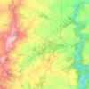
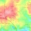
A Barrela topographic map

Click on the map to display elevation.

About this map

Name: A Barrela topographic map, elevation, terrain.

Location: A Barrela, Carballedo, Chantada, Lugo, Galicia, 27520, España (42.51976 -7.83302 42.55976 -7.79302)

Average elevation: 627 m

Minimum elevation: 517 m

Maximum elevation: 727 m

Other topographic maps

Click on a map to view its topography, its elevation and its terrain.

Erbedeiro

España > Galicia > Chantada

Average elevation: 407 m

Chantada

España > Galicia > Chantada

Average elevation: 637 m

Taboada dos Freires

España > Galicia > Chantada

Average elevation: 627 m

Pedrafita

España > Galicia > Chantada

Average elevation: 501 m

Pesqueiras

España > Galicia > Chantada

Average elevation: 488 m

Merlán

España > Galicia > Chantada

Average elevation: 543 m

Marzás

España > Galicia > Chantada

Average elevation: 628 m

Carballedo

España > Galicia > Chantada

Average elevation: 576 m

Taboada

España > Galicia > Chantada

Average elevation: 556 m

Río Búbal

España > Galicia > Chantada > A Peroxa

Average elevation: 561 m

A Cova

España > Galicia > Chantada

Average elevation: 452 m

Fornas

España > Galicia > Chantada > Chantada

Average elevation: 554 m

Vilela

España > Galicia > Chantada > Taboada

Average elevation: 493 m

Sobrecedo

España > Galicia > Chantada > Taboada

Average elevation: 436 m

Chantada

España > Galicia > Chantada

Average elevation: 637 m

Carballedo

España > Galicia > Chantada

Average elevation: 576 m

Gear up for your next adventure:

🛏️Sleeping Bag - Warm and compact sleeping bags for outdoor camping
🧢Hiking Hat - Sun-protective and breathable hats for long treks
🥾Waterproof Hiking Shoes - Durable shoes for wet and rugged trails
🧥Ultralight Puffy Jacket - Maximum warmth that packs down to the size of an orange
🥫Freeze-Dried Meals - Lightweight, high-calorie nutrition for multi-day treks

As an Amazon Associate, this site earns from qualifying purchases at no extra cost to you.