Geolocate

Lake Adger topographic map

Click on the map to display elevation.

About this map

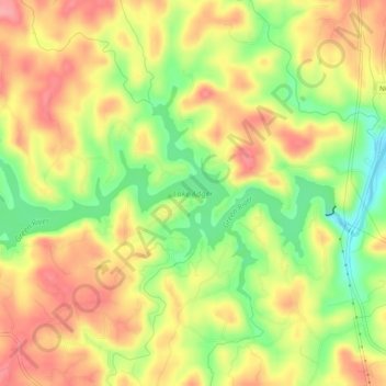
Name: Lake Adger topographic map, elevation, terrain.

Location: Lake Adger, Polk County, North Carolina, United States (35.32636 -82.23552 35.34852 -82.18700)

Average elevation: 312 m

Minimum elevation: 254 m

Maximum elevation: 358 m

Other topographic maps

Click on a map to view its topography, its elevation and its terrain.

Beulah

United States > North Carolina > Polk County

Average elevation: 287 m

Mill Spring

United States > North Carolina > Polk County

Average elevation: 318 m

Cox

United States > North Carolina > Polk County

Average elevation: 251 m

Peniel

United States > North Carolina > Polk County

Average elevation: 326 m

Mill Spring

United States > North Carolina > Polk County

Average elevation: 318 m

Howard Gap

United States > North Carolina > Polk County

Average elevation: 573 m

Gear up for your next adventure:

🐕Hiking Dog Pack - Let your canine companion carry their own water and food
🥾Mountain Hiking Boots - High-traction boots for rocky terrain
🥾All-Terrain Hiking Boots - Versatile boots for varied hiking conditions
🔨Vehicle Emergency Tool - Safety tool for remote road trips to trailheads
🥾Lightweight Hiking Shoes - Comfortable shoes for day hikes

As an Amazon Associate, this site earns from qualifying purchases at no extra cost to you.