
Ometepec topographic map
Interactive map
Click on the map to display elevation.
About this map
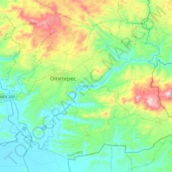
Name: Ometepec topographic map, elevation, terrain.
Location: Ometepec, Guerrero, México (16.54520 -98.50308 16.79988 -98.19378)
Average elevation: 294 m
Minimum elevation: 12 m
Maximum elevation: 1,115 m