Geolocate

Clanezzo topographic map

Click on the map to display elevation.

About this map

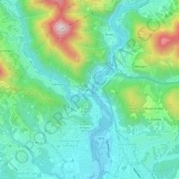
Name: Clanezzo topographic map, elevation, terrain.

Location: Clanezzo, Ubiale Clanezzo, Bergamo, Lombardy, 24010, Italy (45.74191 9.58252 45.78191 9.62252)

Average elevation: 401 m

Minimum elevation: 240 m

Maximum elevation: 858 m

Gear up for your next adventure:

🏕️Camping Hammock - Integrated protection for sleeping between trees
🧣Evaporative Cooling Towel - Beat the heat during intense summer climbs
🎒Hiking Daypack - Lightweight and durable backpacks for day trips and excursions
🔭Compact Binoculars - Lightweight optics for scouting trails and wildlife
🥾Lightweight Hiking Shoes - Comfortable shoes for day hikes

As an Amazon Associate, this site earns from qualifying purchases at no extra cost to you.