Geolocate

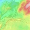
Les Vergers topographic map

Click on the map to display elevation.

About this map

Name: Les Vergers topographic map, elevation, terrain.

Location: Les Vergers, Maîche, Montbéliard, Doubs, Bourgogne-Franche-Comté, France métropolitaine, 25120, France (47.23177 6.78613 47.27177 6.82613)

Average elevation: 817 m

Minimum elevation: 676 m

Maximum elevation: 982 m

Other topographic maps

Click on a map to view its topography, its elevation and its terrain.
25120

France > Bourgogne-Franche-Comté > Doubs > Maîche > Le Jay

Average elevation: 765 m

Gear up for your next adventure:

🧴Sunscreen SPF - Broad-spectrum sunscreen for outdoor activities
🧥Packable Rain Jacket - Breathable waterproof layer for unpredictable weather
👟Sport Hiking Sandals - Breathable footwear for water crossings and camp rest
🩹Moleskin Blister Pads - Direct protection for painful foot pressure points
🧴Waterproofing Spray - Restore the DWR coating on jackets and tents

As an Amazon Associate, this site earns from qualifying purchases at no extra cost to you.