
Make a donation
Gear up for your next adventure:
As an Amazon Associate, this site earns from qualifying purchases at no extra cost to you.
Eckersdorf topographic map
Click on the map to display elevation.
Make a donation
Gear up for your next adventure:
As an Amazon Associate, this site earns from qualifying purchases at no extra cost to you.
About this map
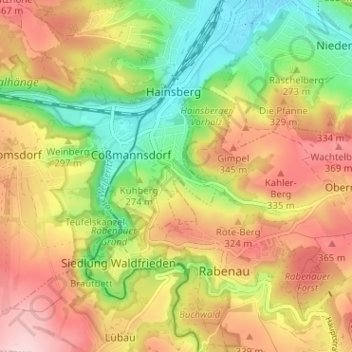
Name: Eckersdorf topographic map, elevation, terrain.
Average elevation: 288 m
Minimum elevation: 174 m
Maximum elevation: 401 m
Make a donation
Gear up for your next adventure:
As an Amazon Associate, this site earns from qualifying purchases at no extra cost to you.
Other topographic maps
Click on a map to view its topography, its elevation and its terrain.
Windberg
Deutschland > Sachsen > Sächsische Schweiz-Osterzgebirge > Freital
Der Aufstieg von Süden aus Richtung Niederhäslich und von Norden aus Richtung Burgk führt jeweils über steile Wanderwege durch Buchen-, dabei insbesondere Hainbuchen- und Eichenwald hinauf. Von Osten aus Richtung Bannewitz gelangt man ohne die Überwindung größerer Höhenunterschiede zum…
Average elevation: 253 m
Zauckerode
Deutschland > Sachsen > Sächsische Schweiz-Osterzgebirge > Freital
Average elevation: 223 m
Hainsberg
Deutschland > Sachsen > Sächsische Schweiz-Osterzgebirge > Freital
Hainsberg befindet sich im Südwesten des Stadtgebietes. In der Gemarkung vereinigen sich die aus dem Rabenauer Grund von rechts kommende Rote Weißeritz und die aus Richtung Tharandt kommende Wilde Weißeritz zur Weißeritz, die durch das östliche Döhlener Becken im Freitaler Stadtgebiet nach Nordosten…
Average elevation: 269 m
Make a donation
Gear up for your next adventure:
As an Amazon Associate, this site earns from qualifying purchases at no extra cost to you.