
Thank you for supporting this site ❤️
Make a donation
Make a donation
Gear up for your next adventure:
As an Amazon Associate, this site earns from qualifying purchases at no extra cost to you.
Grdoči topographic map
Click on the map to display elevation.
Thank you for supporting this site ❤️
Make a donation
Make a donation
Gear up for your next adventure:
As an Amazon Associate, this site earns from qualifying purchases at no extra cost to you.
About this map
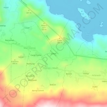
Name: Grdoči topographic map, elevation, terrain.
Location: Grdoči, Veliki Ostros, Bar Municipality, 85306, Montenegro (42.06475 19.30260 42.10475 19.34260)
Average elevation: 236 m
Minimum elevation: -4 m
Maximum elevation: 658 m
Thank you for supporting this site ❤️
Make a donation
Make a donation
Gear up for your next adventure:
As an Amazon Associate, this site earns from qualifying purchases at no extra cost to you.