Geolocate

Cerro Prieto topographic map

Click on the map to display elevation.

About this map

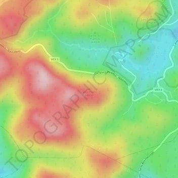
Name: Cerro Prieto topographic map, elevation, terrain.

Location: Cerro Prieto, Isidro Fabela, State of Mexico, 04830, Mexico (19.52189 -99.47923 19.52199 -99.47913)

Average elevation: 3,415 m

Minimum elevation: 3,273 m

Maximum elevation: 3,550 m

Gear up for your next adventure:

🧤Thermal Hiking Gloves - Grip-enhanced gloves for cold-weather altitude trekking
🧊Portable Cooler - Keep food and drinks cold during outdoor adventures
🧥Waterproof Hiking Jacket - Protect yourself from rain and wind while hiking
🦌Outdoor Trail Camera - Monitor wildlife activity near your favorite spots
💧Reusable Water Bottle - Durable water bottles for hydration on trails

As an Amazon Associate, this site earns from qualifying purchases at no extra cost to you.