
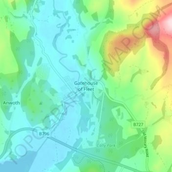
Gatehouse of Fleet topographic map
Interactive map
Click on the map to display elevation.
About this map
Name: Gatehouse of Fleet topographic map, elevation, terrain.
Average elevation: 64 m
Minimum elevation: -3 m
Maximum elevation: 266 m
Other topographic maps
Click on a map to view its topography, its elevation and its terrain.
Langholm
United Kingdom > Scotland > Dumfries and Galloway
Langholm, Dumfries and Galloway, Scotland, DG13 0JQ, United Kingdom
Average elevation: 185 m
Manitou
United Kingdom > Scotland > Dumfries and Galloway
Manitou, Dumfries and Galloway, Scotland, United Kingdom
Average elevation: 167 m
Annan
United Kingdom > Scotland > Dumfries and Galloway
Annan, Dumfries and Galloway, Scotland, DG12 5AW, United Kingdom
Average elevation: 26 m