
Thank you for supporting this site ❤️
Make a donation
Make a donation
Gear up for your next adventure:
As an Amazon Associate, this site earns from qualifying purchases at no extra cost to you.
Steinhaus topographic map
Click on the map to display elevation.
Thank you for supporting this site ❤️
Make a donation
Make a donation
Gear up for your next adventure:
As an Amazon Associate, this site earns from qualifying purchases at no extra cost to you.
About this map
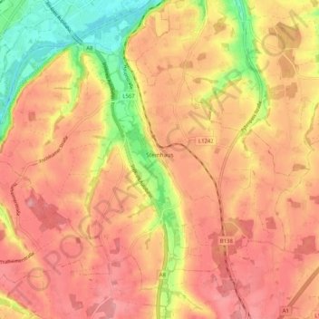
Name: Steinhaus topographic map, elevation, terrain.
Location: Steinhaus, Bezirk Wels-Land, Upper Austria, 4641, Austria (48.08700 13.96631 48.14189 14.06726)
Average elevation: 379 m
Minimum elevation: 312 m
Maximum elevation: 415 m
Thank you for supporting this site ❤️
Make a donation
Make a donation
Gear up for your next adventure:
As an Amazon Associate, this site earns from qualifying purchases at no extra cost to you.
Other topographic maps
Click on a map to view its topography, its elevation and its terrain.
Au an der Traun
Austria > Upper Austria > Bezirk Wels-Land > Marchtrenk > Au an der Traun
Average elevation: 305 m