
Sungai Udang topographic map
Interactive map
Click on the map to display elevation.
About this map
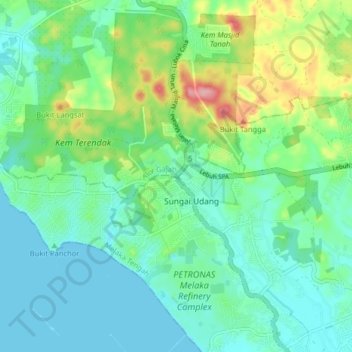
Name: Sungai Udang topographic map, elevation, terrain.
Location: Sungai Udang, Central Malacca, Malacca, 76300, Malaysia (2.26411 102.11389 2.30411 102.15389)
Average elevation: 30 m
Minimum elevation: 0 m
Maximum elevation: 115 m
Other topographic maps
Click on a map to view its topography, its elevation and its terrain.