
Wallau topographic map
Click on the map to display elevation.
About this map
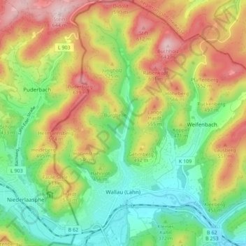
Name: Wallau topographic map, elevation, terrain.
Location: Wallau, Biedenkopf, Landkreis Marburg-Biedenkopf, Hesse, Germany (50.91635 8.44940 50.96972 8.51217)
Average elevation: 428 m
Minimum elevation: 275 m
Maximum elevation: 638 m
Other topographic maps
Click on a map to view its topography, its elevation and its terrain.
Aurorahütte
Germany > Hesse > Landkreis Marburg-Biedenkopf > Gladenbach > Erdhausen
Average elevation: 298 m