Geolocate

Bichom topographic map

Click on the map to display elevation.

About this map

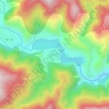
Name: Bichom topographic map, elevation, terrain.

Location: Bichom, Singchung ADC, West Kameng, Arunachal Pradesh, India (27.28490 92.59228 27.32490 92.63228)

Average elevation: 1,051 m

Minimum elevation: 679 m

Maximum elevation: 1,528 m

Gear up for your next adventure:

🥾Hiking Gaiters - Protect legs and shoes from mud, snow, and debris
🧦Merino Wool Socks - Moisture-wicking comfort for long-distance hiking
🥾Trekking Poles - Adjustable trekking poles to reduce knee stress and improve stability
🥾Hiking Shorts - Breathable shorts suitable for summer hikes
🛏️Camping Sleeping Mat - Comfortable mats for sleeping outdoors

As an Amazon Associate, this site earns from qualifying purchases at no extra cost to you.