Geolocate

Ramsau topographic map

Click on the map to display elevation.

About this map

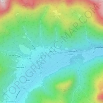
Name: Ramsau topographic map, elevation, terrain.

Location: Ramsau, Gosau, Bezirk Gmunden, Upper Austria, 4824, Austria (47.56840 13.52252 47.60840 13.56252)

Average elevation: 966 m

Minimum elevation: 708 m

Maximum elevation: 1,651 m

Gear up for your next adventure:

🧴Sunscreen SPF - Broad-spectrum sunscreen for outdoor activities
🧭GPS Tracker - Track your location in remote areas safely
🧦Thermal Socks - Warm socks for winter hiking or camping
Camping Tent - Weather-resistant tents suitable for 2 to 6 people
🚲Handlebar Phone Mount - View topographic-map.com live while cycling

As an Amazon Associate, this site earns from qualifying purchases at no extra cost to you.