
Fircrest topographic map
Click on the map to display elevation.
About this map
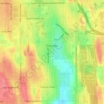
Name: Fircrest topographic map, elevation, terrain.
Location: Fircrest, Pierce County, Washington, United States (47.21723 -122.52646 47.24288 -122.50499)
Average elevation: 96 m
Minimum elevation: 52 m
Maximum elevation: 128 m
Other topographic maps
Click on a map to view its topography, its elevation and its terrain.
Charlotte's Blueberry Park
United States > Washington > Pierce County > Tacoma
Average elevation: 121 m