
Thank you for supporting this site ❤️
Make a donation
Make a donation
Gear up for your next adventure:
As an Amazon Associate, this site earns from qualifying purchases at no extra cost to you.
Indragarh topographic map
Click on the map to display elevation.
Thank you for supporting this site ❤️
Make a donation
Make a donation
Gear up for your next adventure:
As an Amazon Associate, this site earns from qualifying purchases at no extra cost to you.
About this map
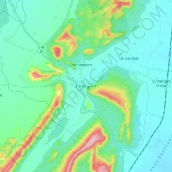
Name: Indragarh topographic map, elevation, terrain.
Location: Indragarh, Indargarh Tehsil, Bundi, Rajasthan, 323613, India (25.68835 76.15137 25.76835 76.23137)
Average elevation: 286 m
Minimum elevation: 226 m
Maximum elevation: 498 m
Thank you for supporting this site ❤️
Make a donation
Make a donation
Gear up for your next adventure:
As an Amazon Associate, this site earns from qualifying purchases at no extra cost to you.