
Arrabloy topographic map
Interactive map
Click on the map to display elevation.
About this map
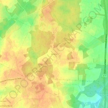
Name: Arrabloy topographic map, elevation, terrain.
Average elevation: 178 m
Minimum elevation: 153 m
Maximum elevation: 192 m
Other topographic maps
Click on a map to view its topography, its elevation and its terrain.
Gien
Frankrijk > Centre-Val de Loire > Loiret > Gien
Gien, Montargis, Loiret, Centre-Val de Loire, Metropolitaans Frankrijk, 45500, Frankrijk
Average elevation: 152 m