
Make a donation
Gear up for your next adventure:
As an Amazon Associate, this site earns from qualifying purchases at no extra cost to you.
Winterspüren topographic map
Click on the map to display elevation.
Make a donation
Gear up for your next adventure:
As an Amazon Associate, this site earns from qualifying purchases at no extra cost to you.
About this map
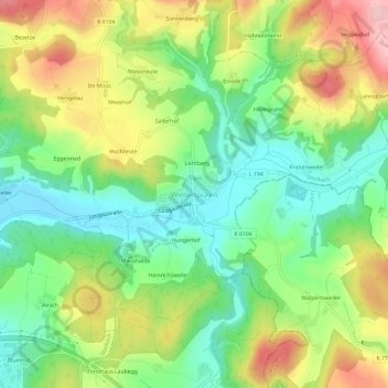
Name: Winterspüren topographic map, elevation, terrain.
Average elevation: 555 m
Minimum elevation: 479 m
Maximum elevation: 666 m
Make a donation
Gear up for your next adventure:
As an Amazon Associate, this site earns from qualifying purchases at no extra cost to you.
Other topographic maps
Click on a map to view its topography, its elevation and its terrain.
Wahlwies
Deutschland > Baden-Württemberg > Landkreis Konstanz > Stockach
Oberhalb der Leonhardstraße, bei Flusskilometer 8,482, befindet sich der Pegel Wahlwies / Stockacher Aach der Hochwasser-Vorhersage-Zentrale Baden-Württemberg und der Landesanstalt für Umwelt, Messungen und Naturschutz Baden-Württemberg (LUBW); Betreiber ist das Regierungspräsidium Freiburg, die…
Average elevation: 467 m
Make a donation
Gear up for your next adventure:
As an Amazon Associate, this site earns from qualifying purchases at no extra cost to you.