Geolocate

Dalig topographic map

Click on the map to display elevation.

About this map

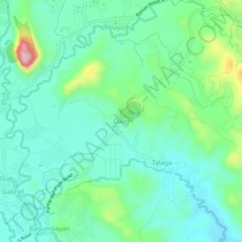
Name: Dalig topographic map, elevation, terrain.

Location: Dalig, Teresa, Rizal, Calabarzon, 1880, Philippines (14.54797 121.21101 14.58797 121.25101)

Average elevation: 73 m

Minimum elevation: 19 m

Maximum elevation: 241 m

Other topographic maps

Click on a map to view its topography, its elevation and its terrain.

Teresa River

Philippines > Rizal > Teresa > Bagumbayan

Average elevation: 73 m

Gear up for your next adventure:

🧤Rechargeable Heated Gloves - Extreme warmth for Canadian winter expeditions
💧Filtered Water Bottle - Safe drinking water on the go
🥾Waterproof Trail Shoes - Shoes designed to handle wet terrain
🔦LED Flashlight - Powerful and long-lasting flashlight for camping and emergencies
🥾Hiking Shorts - Breathable shorts suitable for summer hikes

As an Amazon Associate, this site earns from qualifying purchases at no extra cost to you.