Geolocate

A Cal topographic map

Click on the map to display elevation.

About this map

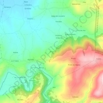
Name: A Cal topographic map, elevation, terrain.

Location: A Cal, Calvor, Sarria, Lugo, Galicia, 27619, España (42.75680 -7.37128 42.79680 -7.33128)

Average elevation: 517 m

Minimum elevation: 415 m

Maximum elevation: 688 m

Other topographic maps

Click on a map to view its topography, its elevation and its terrain.

Chorente

España > Galicia > Sarria > Sarria

Average elevation: 626 m

Barbadelo

España > Galicia > Sarria > Sarria

Average elevation: 576 m

Ortoá

España > Galicia > Sarria > Sarria

Average elevation: 614 m

Louseiro

España > Galicia > Sarria > Sarria

Average elevation: 507 m

Vilamaior

España > Galicia > Sarria > Sarria

Average elevation: 623 m

Santo André de Paradela

España > Galicia > Sarria > Sarria

Average elevation: 578 m

Fontao

España > Galicia > Sarria > Sarria

Average elevation: 460 m

Gear up for your next adventure:

🛏️Sleeping Bag - Warm and compact sleeping bags for outdoor camping
🧰Survival Kit - Essential gear for emergencies in the wilderness
🥤Collapsible Travel Cup - Saves space and weight in your mess kit
🛁Quick-Dry Microfiber Towel - Space-saving towel that dries rapidly on the move
🔪Outdoor Multitool - Versatile tool for repairs and food prep in the wild

As an Amazon Associate, this site earns from qualifying purchases at no extra cost to you.