Geolocate

Archer topographic map

Click on the map to display elevation.

About this map

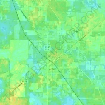
Name: Archer topographic map, elevation, terrain.

Location: Archer, Alachua County, Florida, 32618, United States (29.51729 -82.55653 29.56747 -82.46491)

Average elevation: 25 m

Minimum elevation: 17 m

Maximum elevation: 35 m

Other topographic maps

Click on a map to view its topography, its elevation and its terrain.

Earleton

United States > Florida > Alachua County

Average elevation: 46 m

Island Grove

United States > Florida > Alachua County

Average elevation: 18 m

Misty Oaks

United States > Florida > Alachua County

Average elevation: 21 m

Bland

United States > Florida > Alachua County

Average elevation: 44 m

Archer

United States > Florida > Alachua County > Archer

Average elevation: 25 m

Gear up for your next adventure:

🔦UV Flashlight - Detect minerals or specific insects in the dark
💧Hydration Pack - Hands-free hydration system for long hikes
🥾Trail Running Shoes - Lightweight and durable shoes for trail running
🛶Canoe Life Vest - Safety vest for water sports
👟Leg Gaiters - Keep debris, mud, and snow out of your boots

As an Amazon Associate, this site earns from qualifying purchases at no extra cost to you.