Geolocate

Agiez topographic map

Click on the map to display elevation.

About this map

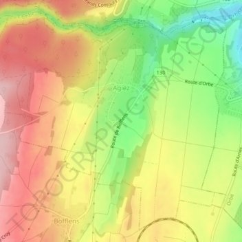
Name: Agiez topographic map, elevation, terrain.

Location: Agiez, District du Jura-Nord vaudois, Vaud, 1352, Switzerland (46.70352 6.48524 46.72861 6.52576)

Average elevation: 559 m

Minimum elevation: 452 m

Maximum elevation: 646 m

Other topographic maps

Click on a map to view its topography, its elevation and its terrain.

Gear up for your next adventure:

🛶Waterproof Dry Bags - Keep electronics and clothes dry during river crossings
🧢Hiking Hat - Sun-protective and breathable hats for long treks
🧤Insulated Winter Gloves - Heavy-duty protection for sub-zero Canadian adventures
🧰Emergency Multi-Tool - Compact multi-tool for outdoor survival
🧰Multitool Knife - Compact and versatile tool for outdoor use

As an Amazon Associate, this site earns from qualifying purchases at no extra cost to you.