Geolocate

Conflent topographic map

Click on the map to display elevation.

About this map

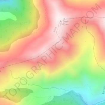
Name: Conflent topographic map, elevation, terrain.

Location: Conflent, Farrera, Pallars Sobirà, Lleida, Catalonia, Spain (42.49993 1.34235 42.51993 1.36235)

Average elevation: 2,214 m

Minimum elevation: 1,748 m

Maximum elevation: 2,574 m

Gear up for your next adventure:

🥾Lightweight Hiking Shoes - Comfortable shoes for day hikes
🧭GPS Tracker - Track your location in remote areas safely
🧭GPS Handheld Device - Reliable GPS navigation for outdoor adventures
Family Camping Tent - Spacious tent suitable for family camping trips
🥾Mountain Hiking Shoes - Shoes with superior grip for mountainous terrain

As an Amazon Associate, this site earns from qualifying purchases at no extra cost to you.