Geolocate

Ordèn topographic map

Click on the map to display elevation.

About this map

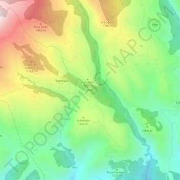
Name: Ordèn topographic map, elevation, terrain.

Location: Ordèn, Bellver de Cerdanya, Cerdaña, Cataluña, 25721, España (42.38148 1.75398 42.42148 1.79398)

Average elevation: 1,482 m

Minimum elevation: 1,085 m

Maximum elevation: 2,093 m

Gear up for your next adventure:

Backpacking Tent - Lightweight tent for long-distance hiking trips
🔭Compact Monocular - One-handed bird watching and trail spotting
🔨Vehicle Emergency Tool - Safety tool for remote road trips to trailheads
💡LED Headlamp - Hands-free illumination for night hiking and camping
🥾Mountain Hiking Shoes - Shoes with superior grip for mountainous terrain

As an Amazon Associate, this site earns from qualifying purchases at no extra cost to you.