
Thank you for supporting this site ❤️
Make a donation
Make a donation
Gear up for your next adventure:
As an Amazon Associate, this site earns from qualifying purchases at no extra cost to you.
Sombrero topographic map
Click on the map to display elevation.
Thank you for supporting this site ❤️
Make a donation
Make a donation
Gear up for your next adventure:
As an Amazon Associate, this site earns from qualifying purchases at no extra cost to you.
About this map
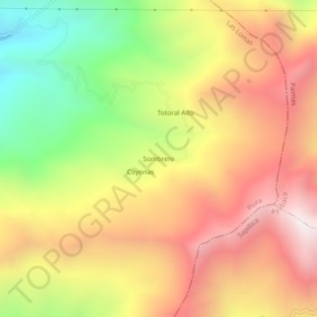
Name: Sombrero topographic map, elevation, terrain.
Location: Sombrero, Las Lomas, Piura, Perú (-4.70884 -80.04482 -4.66884 -80.00482)
Average elevation: 1,295 m
Minimum elevation: 557 m
Maximum elevation: 1,931 m
Thank you for supporting this site ❤️
Make a donation
Make a donation
Gear up for your next adventure:
As an Amazon Associate, this site earns from qualifying purchases at no extra cost to you.