Geolocate

Bandita topographic map

Click on the map to display elevation.

About this map

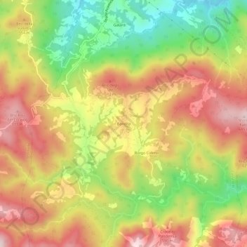
Name: Bandita topographic map, elevation, terrain.

Location: Bandita, Cassinelle, Alessandria, Piemonte, Italia (44.55495 8.53328 44.59495 8.57328)

Average elevation: 492 m

Minimum elevation: 278 m

Maximum elevation: 679 m

Gear up for your next adventure:

🔥Emergency Fire Starter - Reliable ignition source for all weather conditions
🪑Ultralight Camping Stool - Compact seating for rest stops during long hikes
🧴Insect Repellent - Protect yourself from bugs during outdoor adventures
🥾Mountain Hiking Boots - High-traction boots for rocky terrain
🧥Waterproof Pants - Keep dry during rainy hiking conditions

As an Amazon Associate, this site earns from qualifying purchases at no extra cost to you.