Geolocate

Runcu topographic map

Click on the map to display elevation.

About this map

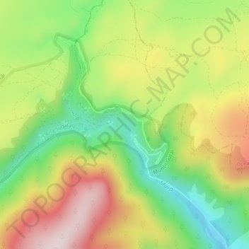
Name: Runcu topographic map, elevation, terrain.

Location: Runcu, Desești, Maramureș, Romania (47.79896 23.76756 47.79906 23.76766)

Average elevation: 804 m

Minimum elevation: 603 m

Maximum elevation: 1,033 m

Gear up for your next adventure:

💡LED Headlamp - Hands-free illumination for night hiking and camping
🧢Beanie Hat - Keep your head warm in cold weather
🌡️Emergency Mylar Blankets - Compact thermal protection for unexpected nights outdoors
🧦Hiking Liner Socks - Thin base layer to prevent friction and blisters
🧴Bear Spray Holster - Quick-access carry for essential Canadian wilderness safety

As an Amazon Associate, this site earns from qualifying purchases at no extra cost to you.