
Thank you for supporting this site ❤️
Make a donation
Make a donation
Gear up for your next adventure:
As an Amazon Associate, this site earns from qualifying purchases at no extra cost to you.
Ribadesella / Ribeseya topographic map
Click on the map to display elevation.
Thank you for supporting this site ❤️
Make a donation
Make a donation
Gear up for your next adventure:
As an Amazon Associate, this site earns from qualifying purchases at no extra cost to you.
About this map
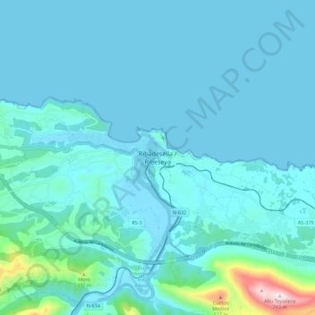
Name: Ribadesella / Ribeseya topographic map, elevation, terrain.
Location: Ribadesella / Ribeseya, Ribeseya, Asturies, 33560, Espagne (43.42180 -5.09886 43.50180 -5.01886)
Average elevation: 67 m
Minimum elevation: -3 m
Maximum elevation: 733 m
Thank you for supporting this site ❤️
Make a donation
Make a donation
Gear up for your next adventure:
As an Amazon Associate, this site earns from qualifying purchases at no extra cost to you.